Dispatches from the Oilseed and Grain Trade Summit in Minneapolis
Flip to El Nino may bring downturn in corn, soybean growth in Americas in late 2016

Corey Cherr, head of agriculture and weather research and forecasts at Thomson Reuters, said we have had the El Nino weather pattern for a couple of years now it has its effects on the market, so it is really what happens after this current El Nino phase finishes up.
He was speaking on the potential impact of weather events on crop growing at last week’s Oilseed and Grain Trade Summit in Minneapolis.
He said that frequently when there are very strong El Nino events like the “one we are in currently”, they are often followed by a flip to La Nina or a lean towards La Nina – a neutral negative - and that is when you can see a lot of problems in major crop production areas in the western hemisphere.
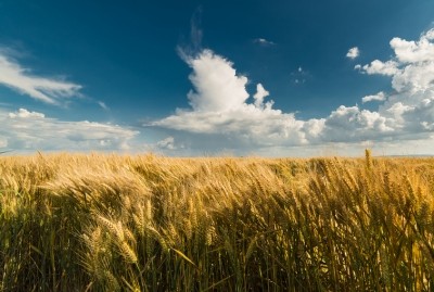
An El Nino is characterized by warmer than usual temperatures off the coast of South America and with warmer winter conditions for many parts of North American, states the US National Oceanic and Atmospheric Administration (NOAA). Such an event tends to bring favorable crop growing conditions in the Americas but can have the opposite effect on production in China, India, South East Asia and Australia.
La Nina periods are marked by below-average surface temperatures for the east-central Equatorial Pacific, according to NOAA.
La Nina impact
After good crop production and low prices in the Americas arising from the El Nino pattern, the switch to a neutral negative or La Nia could negatively impact corn and soybean output in the US, Brazil and Argentina, said Cherr.
“We’ve been in the current strong El Nino phase for a while, with the conditions that characterize that likely to persist through February or March of 2016,” he added.
Afterward, the oceanic surface temperatures tend to quiet and return to more of a usual state, he said. A new system typically starts to be recognizable in June or July.
If a La Nina weather pattern starts, cooler air from Canada isn’t diverted across the corn and wheat belts of the US, he said. Instead, there tends to be more heat and dryer weather.
”The first things you’d look for, is not so much what’s happening in the weather here, it’s over the Pacific Ocean,” he told FeedNavigator. “If we’re moving to La Nina, what we’d expect to see would be the waters off the west coast of South America cooling off.”
The corn and soybean crops in the US will likely see the most interaction with the new weather pattern starting in the latter half of 2016, said Cherr.
In a La Nina years, crops may meet ‘trend’ expectations – or the initial expected yield with normal weather conditions, he said. However, data from past La Nina cycles suggests that meeting the trend yield is a ‘best case scenario’ and there may be questions about meeting crop demands.
“If you head toward La Nina you raise the warning flag, of at best it’s going to be normal, and at worst it will be really bad, and we’ll probably be in-between,” he said.
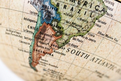
“It tends to be that way also in Argentina and southern Brazil, and because so much of the exportable corn and soybeans are produced in the western hemisphere, it tends to have almost uniformly negative impacts,” continued Cherr. “The current market that is well supplied will probably stay that way through the first half of 2016, and then starting in the second half of 2016 and into 2017, that’s when the crop would be threatened.”
But, the La Nina trend is more positive for crops like wheat and palm oil that are grown in Europe and Asia, he said.
Past trend data
Although many of the predictions about what weather patterns like El Nino and La Nina mean for crop production come from an analysis of historical data, those results may not be as helpful on this cycle, said Cherr.
“Since 1980 there have been two other El Nino events that look to be as strong as this one and it’s not a lot to look at,” he said. “If we’d seen this 10 times we’d have a better feeling.”
In those instances, one came before a major drought in 1983 and the second was followed by a mild year, he said.
“One thing to keep in mind is the world is warmer than it was 20 and 30 years ago, and the ocean surface temperatures are really, really warm,” he said. “Some of the ingredients that could lead to a lot of heat and drought do seem to be there.”