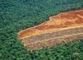
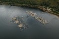
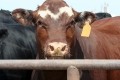
Land use change in Brazil

The fifth most read story in August was an article about a free deforestation tracker.
The new tool assesses deforestation and conversion of native vegetation at the farm level for soy production areas in the Cerrado, Brazil. It also includes Brazilian Forest Code related indicators and other compliance checks.
Users would be buyers of Brazilian soy.
Developed by Brazil based green finance experts, BVRio, the tool covers over 92,000 farms (an area of over 61 million hectares) and with only a farm CAR Number, users can quickly and easily see if there are any deforestation indicators associated with farms in their supply chain.
BVRio director, Grace Blackham leads the project, which is funded by the Waterloo Foundation. “There is a wealth of publicly available and trusted data on land use change in Brazil, but there wasn’t an easy way to navigate it and trace soy production back to individual farms. Building on our experience in creating our Brazilian Timber Due Diligence system and driven by the increasing demand for agricultural commodity traceability due to regulation tightening, we created this new soy production map and tool.”
Photo Credit: GettyImages/louman